The German firm was at
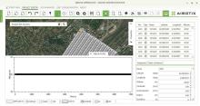
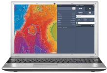
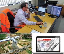
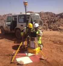
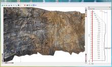
Due to QuarryManager’s deep integration with QuarryX, you can maximise the value of your face profiling/blast design data. Furthermore, it is possible to create cross sections and to do accurate volume calculations. QuarryManager’s direct link to QuarryPocket GPS software allows the user to integrate logged GPS data quickly and easily into the digital quarry/mine map. With all these useful features, QuarryManager is a key tool for quarry/mine documentation and extraction planning.
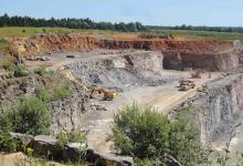
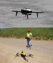
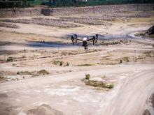
The XR6 UAV (unmanned aerial vehicle) from geo-konzept allows the user to easily create aerial images of a quarry or mine. The autopilot system is very simple to use and the XR6 can be operated by anyone after a short training course run by geo-konzept’s UAV specialists.
The XR6 Survey Bundle creates highly accurate and up-to-date data from your quarry/mine. This data can be imported into QuarryManager software as a digital quarry/mine map, helping managers and service providers with their decision making. Using the XR6 is also said by geo-konzept to improve operational safety, as the pilot can conduct a survey far away from heavy machines or areas where there is risk of rock fall. Combined with VolumeX software, the XR6 is an ideal tool for calculating stockpile volumes. After a point cloud is created from photogrammetric data, just one mouse click is enough for VolumeX to calculate a solid stockpile model including volume and tonnage based on the data.
Meanwhile, the use of geo-konzept’s RiGuide saves a lot of time by not having to manually stake out drill holes, whilst also preventing measurement and communication errors referring to planned drills hole positions.
QuarryX software offers powerful design tools for each type of blast, based on 3D data. To put a design into accurate practice, geo-konzept offers the RiGuide guidance system as a retrofit solution for all common brands of drill rigs.
Speaking at steinexpo 2017, Christian Rammelmeier said: “Our products are very intuitive. You can cover many steps in a few mouse clicks. We are increasing our sales in Eastern Europe and see the region as a big market for us. We’ve already got customers in Germany, Austria and Switzerland. We’ve also had a few sales in North America.”

